
Conigar [An Coinigear]
Good walks are even better shared.
Overview
Conigar [An Coinigear]
Introduction
Conigar, known as An Coinigear in Welsh, is an enchanting Marilyn in the Brecon Beacons National Park. Rising to an elevation of 494 meters, it may not be the highest peak around, but it sure provides a hearty workout and stunning views that could make even the most seasoned hiker stop and say, "Blimey!"
Geology
As you make your way up, you'll notice the fascinating geological formations formed by Old Red Sandstone. These sedimentary rocks tell stories of the Earth's past when rivers and lakes shaped this very land. Don't be surprised if you spot a few fossils hidden among the layers – just don’t expect them to have any particularly exciting tales to share!
Routes
Two popular routes lead to the summit: the Beacons Way and the Brecon to Conigar Loop. Both routes offer spectacular views, with the latter presenting a more challenging option for those looking to really stretch their legs.
Summit Features
Upon reaching the summit, you’ll be greeted by an impressive stone cairn, a traditional sight that marks the highest point. It’s a perfect place to take a photo and contemplate the vastness of the landscape that surrounds you – or just to catch your breath!
Terrain
The terrain here is wonderfully diverse, featuring rocky outcrops perfect for scrambling and grassy slopes that are ideal for the more laid-back hikers. However, tread carefully – mud and boggy patches can be sneaky!
Views
The panoramic views from Conigar are nothing short of spectacular. From the summit, you'll see the majestic Black Mountains to the east and the rolling hills stretching out toward the stunning Welsh coastline. To catch these views at their best, aim for spring or early autumn, ideally in the morning when the sun casts a golden glow over the landscape.
Hazards
Keep an eye on the weather. Conditions can change quicker than you can say 'top of the morning', leading to reduced visibility and slippery paths. Always come prepared, and don’t be that hiker who forgot their waterproof jacket!
Access
Getting here is quite straightforward. The nearest car park is at the Storey Arms outdoor centre, which is a hub for countless trails in the area. Buses run regularly from Brecon, or you can catch a train to Abergavenny and grab a taxi.
Facilities
When nature calls, there are public toilets at the Storey Arms. After your hike, you can treat yourself to a slice of cake and a steaming cup of tea at one of Brecon’s charming cafes.
History
Conigar's name is derived from the Welsh word for rabbit, suggesting a vibrant local fauna in times gone by. Historically, this mountain has been part of a network of trade routes, providing essential pathways for early communities.
In conclusion, whether you are a seasoned hiker or someone simply looking to enjoy a lovely day in nature, Conigar offers an engaging outdoor experience that should not be missed. So, pack your gear, lace up those boots, and let the adventure begin!
Explore routes near Conigar [An Coinigear]
Public walks starting within 80 km of this hill. Nearby does not mean a route reaches the summit; check its map and access before setting out.
No public routes are currently listed within 80 km of Conigar [An Coinigear] on Walkmates. This does not mean there are no paths here. Explore the map and check local access information before planning a walk.
Route planning notes
These notes describe possible approaches, not verified navigable routes or permission to cross land. Check current paths, local access rules and conditions before setting out.
Beacons Way
A scenic route that follows the Beacons Way trail, offering breathtaking views as you ascend.
Brecon to Conigar Loop
This loop offers a more challenging hike, taking you around the base before summiting for a panoramic view.
Make a day of it, together
Find someone to share the walk with, or organise a day out along a route you like.
Hill facts and local notes
Classifications
Elevation
572m
1,877 ft
Prominence
137m
Coordinates
51.8192, -9.3552
W066638
OS Map
85
At the Summit
The summit is adorned with a prominent cairn that serves both as a trail marker and a perfect spot to catch your breath and admire the views below.
Terrain & Geology
The mountain is predominantly made up of Old Red Sandstone, which is characteristic of the area, giving it a stunning reddish hue combined with some limestone features. The sedimentary layers tell a story of ancient riverbeds and lakes.
Views & Scenery
On a clear day, you can see the Black Mountains to the east, the rolling hills of the Brecon Beacons to the west, and the distant peaks of the Welsh coastline.
History & Heritage
Name Origin
The name 'Conigar' likely derives from the Welsh 'Conig', meaning rabbit, hinting at the local wildlife.
Historical Significance
The mountain is part of the historic network of trails that date back to ancient times, often used by shepherds and traders.
Getting There & Facilities
Check current local access restrictions, parking rules and transport timetables before travelling. These notes do not confirm public access to the summit.
Parking
The nearest parking can be found at the Storey Arms outdoor centre, which provides clear access to various trails leading to Conigar.
Public Transport
Regular bus services operate from Brecon to the Storey Arms. For train enthusiasts, Abergavenny station is the closest rail link, from which you can take a taxi.
Nearby Facilities
There are public toilets at the Storey Arms, and several cafes in Brecon if you need to refuel after your hike.
Safety Information
Known Hazards
- Changeable weather conditions can lead to poor visibility. Watch out for sudden rain showers and slippery paths, especially in winter.
General Safety Tips
- Check weather conditions before setting out
- Carry appropriate clothing and equipment
- Let someone know your planned route
- Take a map, compass, and GPS device
- Carry emergency supplies: food, water, first aid kit, torch
Hills
Some common questions about the hills answered
Are there group walks up Conigar [An Coinigear]?
Many walkers use Walkmates to join or organise walks with others. You can check for group walks around Conigar [An Coinigear] through the maps
Are there other walkers around Conigar [An Coinigear]?
Activity varies by location and time, but Walkmates lets you see whether others have shared walks or shown interest in this area. Find other people through the walking friends search walking friends for Conigar [An Coinigear] search or of course create your own walk for Conigar [An Coinigear]
Can I organise a walk to Conigar [An Coinigear]?
Yes. If there aren’t any walks listed already, you can create a walk and make it available for others to join.
If you're signed up to Walkmates, you can create a walk to Conigar [An Coinigear].
How do I find a walk up this hill?
There are often multiple ways to walk this hill, depending on experience and route preference. Walkmates helps you explore walks and routes that others have shared.
Can I suggest a new route up Conigar [An Coinigear]?
Yes. You can suggest or create routes to share with others. Walkmates focuses on the social side of walking, so routes are used to help people organise walks and explore areas together, rather than as detailed navigation tools or route libraries.
Other uses really appreciate knowledgeable walkers sharing their routes. Share your favourite route to Conigar [An Coinigear] here
The is an error or something incorrect about this hill. How do I let you know?
We always strive to keep the information on Walkmates as accurate as possible. If you find an error, please let us know through the contact form and we'll aim to correct it as quickly as possible
Community Discussion
Comments
Location
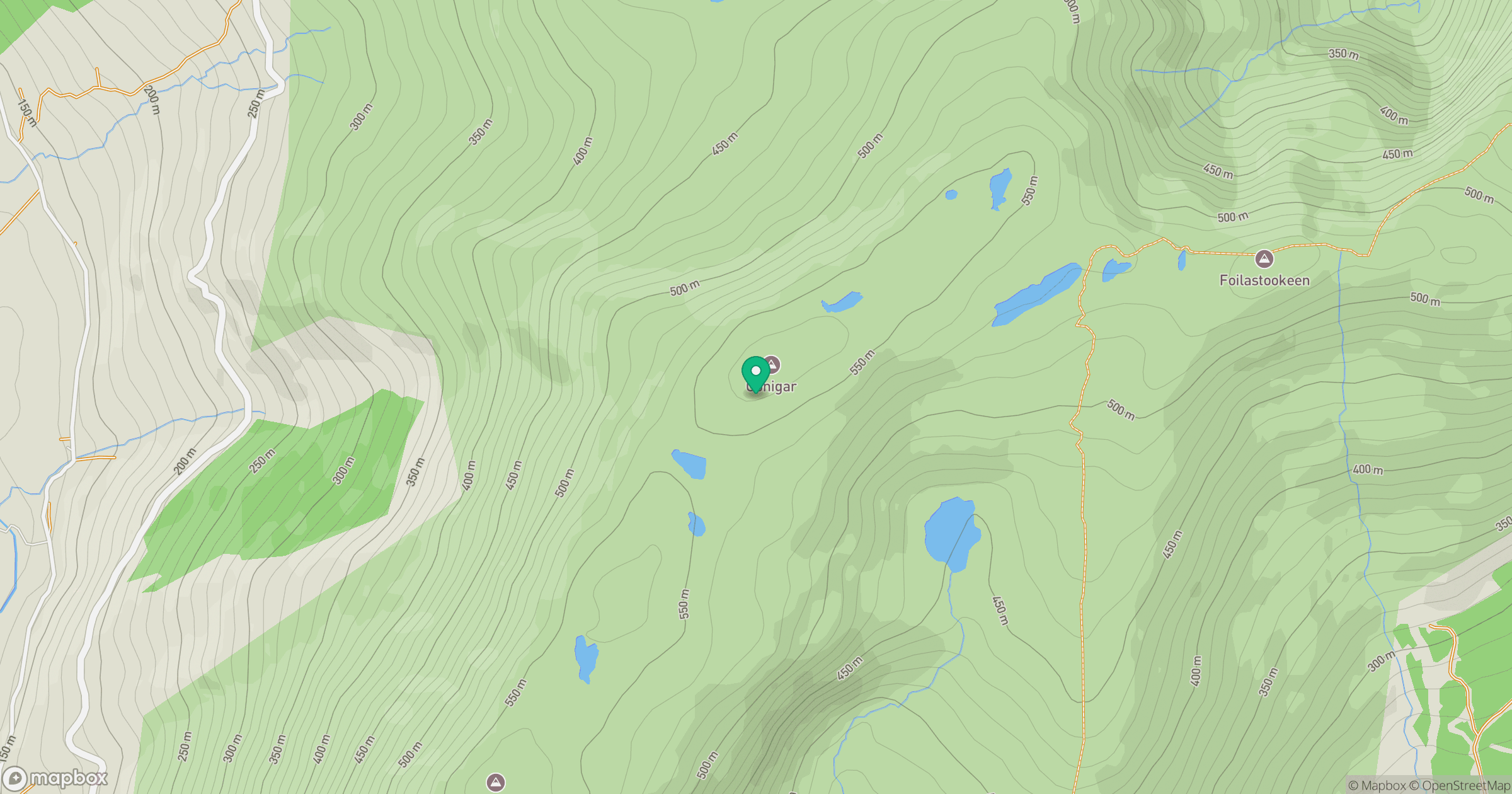
Grid reference: W066638
View on OpenStreetMapOpens a map in a new tab, centred on the hill.
Hills within 30 km
Straight-line distance, not a walking route or confirmation of access.
No comments yet. Be the first.